


Drone Flights Made Easy
Automate drone flights for rooftops, facades, and terrain — get precise data without manual piloting.
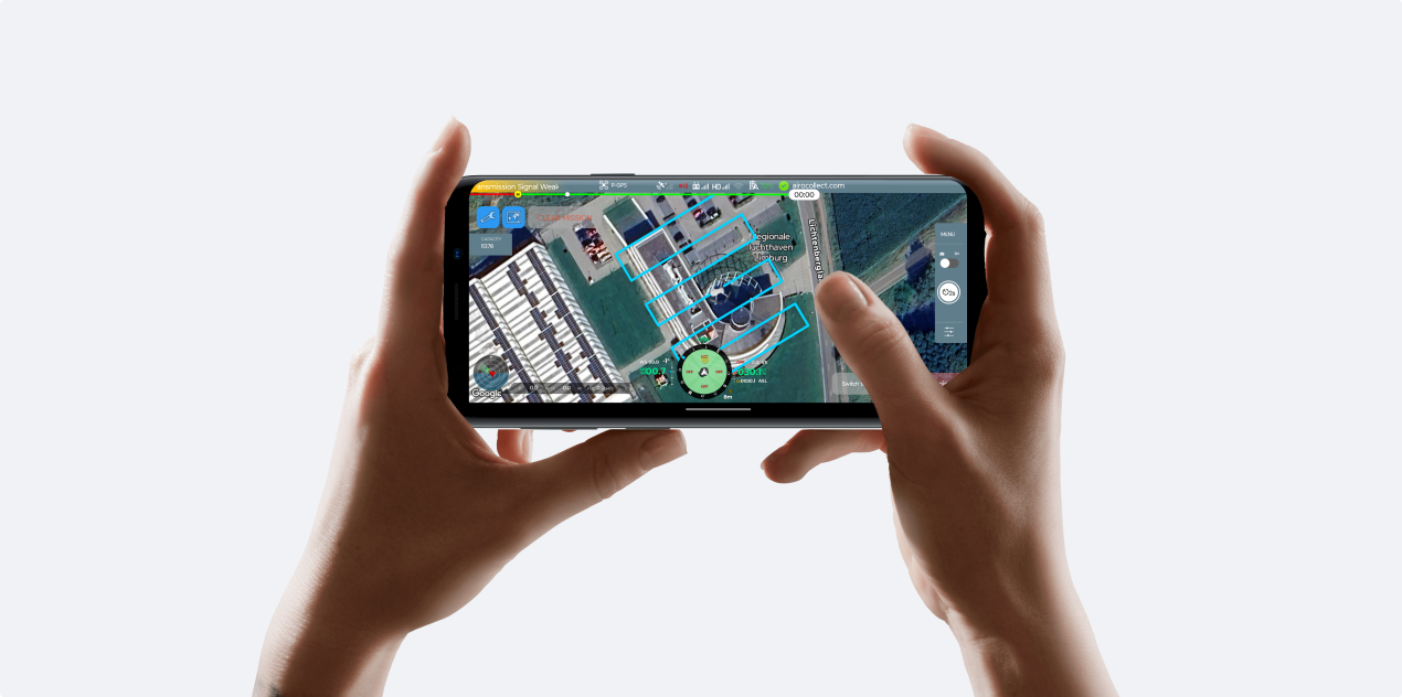
Auto-pilot App
Launch your drone, fly the mission, receive data that’s already prepped for your next steps, from quoting to measuring.
Fly your DJI-drones with RTK accuracy for measurement-grade results.
The fastest flight path for high-quality site scans.
Avoid obstacles, return safely when the battery is low, or when weather conditions change.
Model structures, annotate visuals, and export everything your client or crew needs.
How It Works
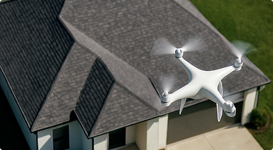
Step 1
Launch the drone
Launch the drone to scan the designated area automatically.
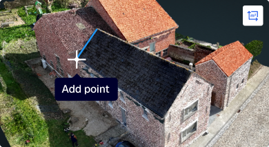
Step 2
Start measuring
Access measurements for your projects.
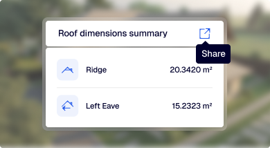
Step 3
Share
Share your design, report, and quotations with your team and clients
Supported Drones
AiroCollect works with most GPS-enabled drones. We support a wide range of DJI models, including the Mini and Mavic series. Below is a list of compatible devices.
If your device isn’t listed, please contact us, and we’ll help you troubleshoot or get set up.
WARNING!
Only works for remote controller with android smartphone!
The Auto-pilot app is compatible with Android phones running version 10 or higher. Tested and supported models include:
Samsung
Galaxy S24 Ultra • Galaxy S23 Ultra • Galaxy S22 Ultra • Galaxy S21 Ultra • Galaxy Note 20 Ultra • Galaxy A54 • Galaxy A53
HUAWEI
Mate X5 • Mate 70 Pro • Mate 70 • Mate 60 Pro • Mate 60 • Mate 50 Pro • Pura 70 pro+ • Pura 70 pro • Pura 70 • P60 pro • P50 pro,
Xiaomi
Xiaomi 15 Pro • Xiaomi 14 Pro • Xiaomi 13 Ultra • Xiaomi 12 Ultra • Xiaomi 11 Ultra • Xiaomi MIX 4 • Xiaomi POCO X5 Pro • nova11 Pro
VIVO
X200 Pro • X100 Pro • S17 Pro • Y78+
OPPO
OPPO Reno 10 Pro
Honor
Honor 90 Pro
OnePlus
Nord CE 3
Google Pixel
Pixel 9 Pro • Pixel 8 Pro
Motorola
G24 • G32
FaQ
Yes, you can. AiroCollect is compatible with any drone that can capture images along with GPS data. If your drone uses RTK-GPS, AiroCollect will automatically detect and adapt to its coordinate system.
If you have a DJI MINI 1, MINI 2 (not SE), or MINI 3, you can download the free AiroCollect Android app from our technical specifications page to enable automatic terrain scanning. (Note: iOS is not supported due to DJI restrictions.)
Your license is valid for the duration of your subscription. If you choose an annual plan, it’s valid for one year. If you choose a monthly plan, it’s valid for one month.
We recommend the DJI MINI 4 PRO. It weighs under 250g, making it one of the easiest and most flexible drones to use.
However, you may need special permission to fly near airports or other restricted zones. Always consider privacy as well — you must have the property owner’s consent before flying over their land. For full details, please check your local government’s drone regulations.
To perform unlimited scans with more than two drones, simply purchase multiple Unlimited plans. For example, if you buy two plans, you can use up to four drones.
If you don’t see the answer to your question send us a message and we will answer you as soon as possible, within a few hours.
Enjoy 30 days of full access to advanced measurement tools — completely free. No credit card needed.
Please fill in the information with * below
We will contact you as soon as possible
Please fill in the information with * below
Press demo video to have direct access