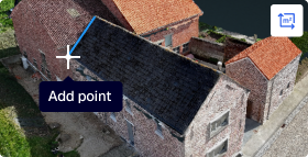
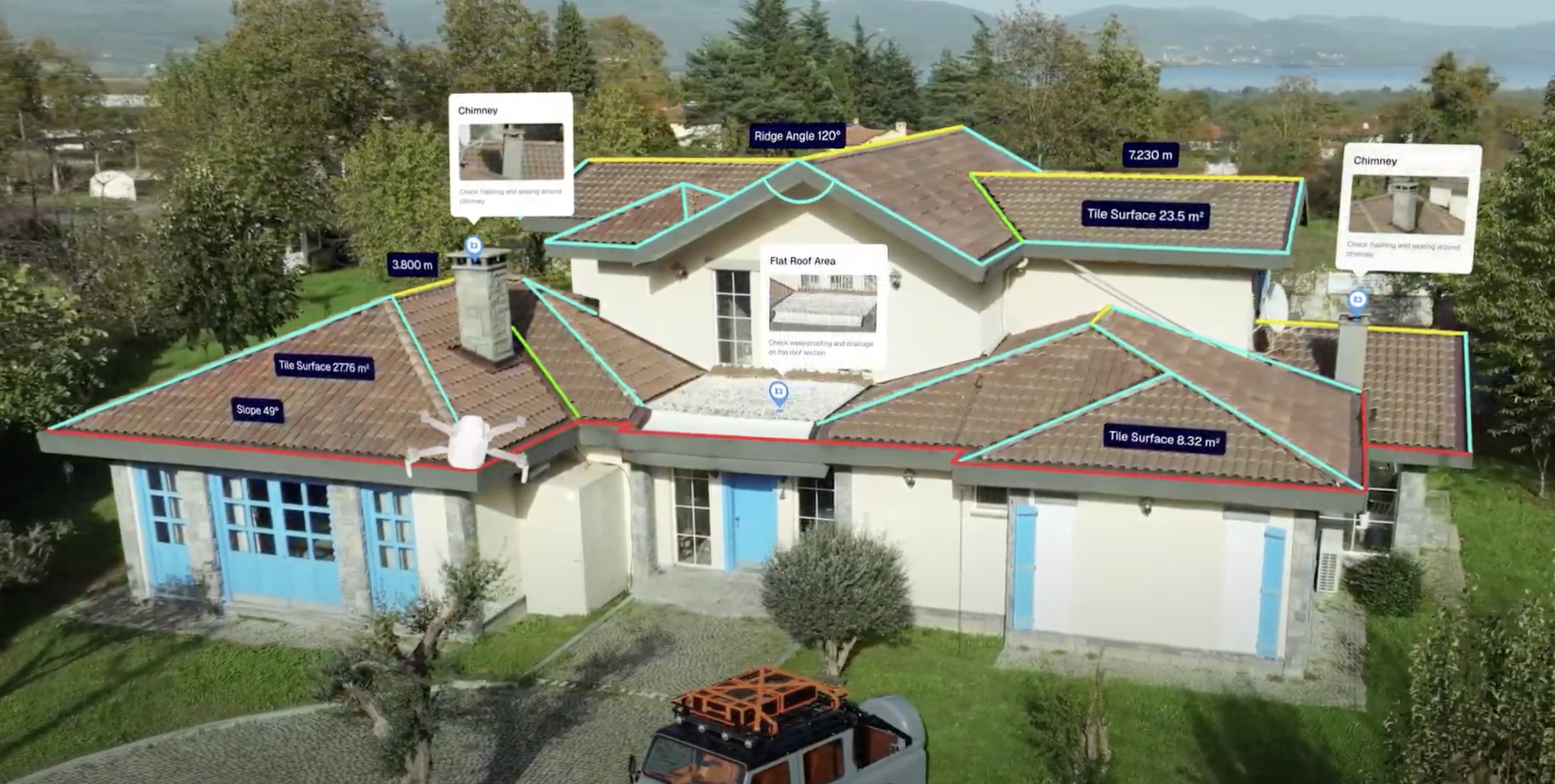
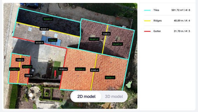
Manual roof measurements slow you down and lead to costly mistakes. AiroCollect gives you complete, reliable roof data, so you can quote faster and with more confidence.
Since implementing Airocollect in our renewables business, we have been thoroughly impressed. In
our opinion, it offers the best combination of value for money and software capability on the market.
Having used several other drone mapping platforms, Airocollect stands out as the best by far. The
customer support has also been outstanding; Stijn has been incredibly responsive and helpful with
all of our questions. The exciting product roadmap gives us great confidence in our long-term
partnership. We couldn't recommend Airocollect more highly.
Ben Pearcy UK
This software is a game-changer for our roofi ng business! The ability to fl y my drone, upload photos, and create a 3D scan with up to 99% accuracy has made measurements more precise and effi cient. It's incredibly easy to use, and the multiple functions—whether for roofi ng, scaffolding, or solar—are intuitive and versatile. I especially love how simple it is to share the results with clients, adding a professional touch to our presentations. Highly recommend this to anyone in the trade looking to save time and improve accuracy!
Lee MoranUK
Excellent support and customer service.
Main Flug
Great product! Fantastic features! Perfect support! Awesome team!
Frederik De Vylder
No need to fuss with ladders, lasers, or meters. Calculating dimensions, height, length, and surface area is also done quickly and with the utmost accuracy. Service is also very important to us, which is certainly the case with Airocollect. We work with them to fi nd solutions and are constantly striving for improvements. In short, it saves us a lot of time, and safety is also very important. So, defi nitely recommended for every roofer.
Freddy Van OpstalThe Netherlands
Great software, I was able to test another software before airocollect, but this one is more intuitive, more complete. The technical service is also very available if you need advice. I have been using airocollect for 4 years and I can only recommend it.
Nicolas Dettwiller
In addition to their excellent IT software, they have a customer-friendly internal service team that always answers the phone when something goes wrong. They immediately look for a suitable solution.
Edifex
Airocollect provides an effi cient and accurate method for drone surveys. Ideal for companies that want to move quickly.
Martijn Koopmans
AiroCollect offers outstanding service! The intuitive user interface and effi cient data capture have signifi cantly improved our workfl ow. The support team responds quickly and competently to inquiries. We are extremely satisfi ed and can wholeheartedly recommend AiroCollect!
Matthias Bender
I'm incredibly happy with Aircollect! The team is very professional and always responds quickly, whether I contact them via support, email, or phone. Since purchasing my drone and the Aircollect software, I haven't regretted it for a moment. Measuring gardens is now a real pleasure, and as a landscape architect, I can now do the measurements myself. Aircollect has made my job much easier.
Anja Van Renterghem
Very helpful and friendly people. We use the software and are very satisfi ed with the features and the follow-up. They take the time to explain everything thoroughly with demos and ensure you can use the software properly.
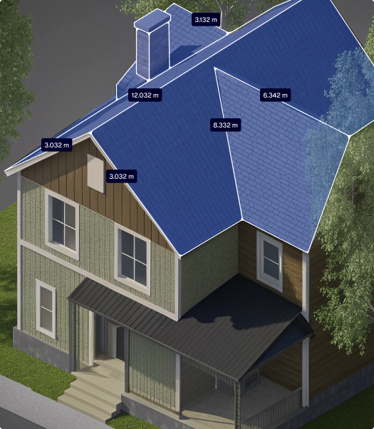
Handle multi-level, irregular, and steep roofs effortlessly.
Easier Workdays
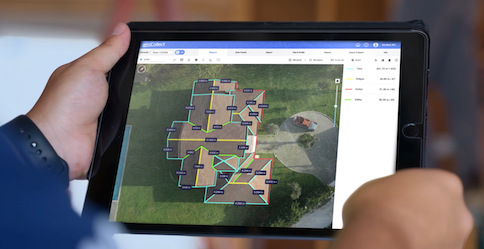
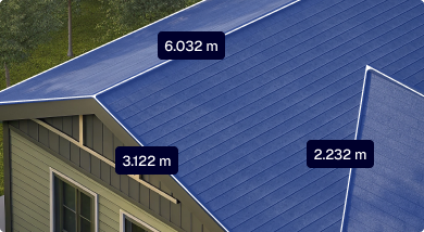
Create detailed models using drones or instant models using Aerial data.
Faster Quotes
Instantly generate project estimates by linking material costs.
Roofer-first
Designed specifically for professional roofing companies.
Help center
Always Here to Help
Need support flying your drone, optimizing scan results, or solving a technical issue? Our expert support team is always available to assist. Get help the way you prefer.


")
