Built for Roofing & Solar Professionals
With AiroCollect you get a detailed digital model ready to quote, plan, and share. It’s faster, safer, and 10× more efficient than manual work.
Solution
Risking safety by continuously climbing on roofs to measure manually
It takes a lot of time to measure by hand
Incorrect measurements can lead to costly mistakes
Complex roofs are haed to measure, leading to errors
Safe, drone-based data collection
One visit, everything captured
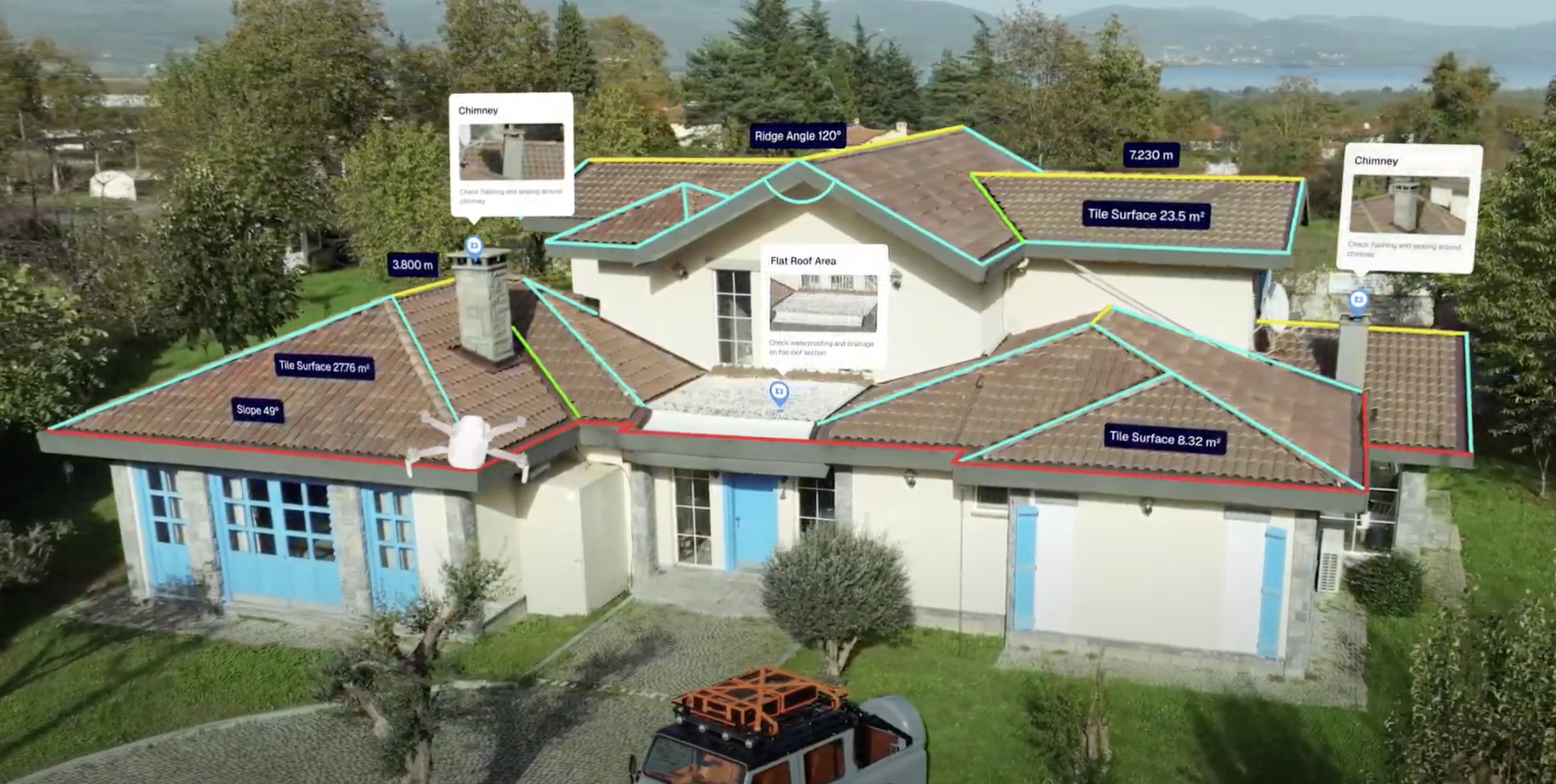
Trustworthy measurements
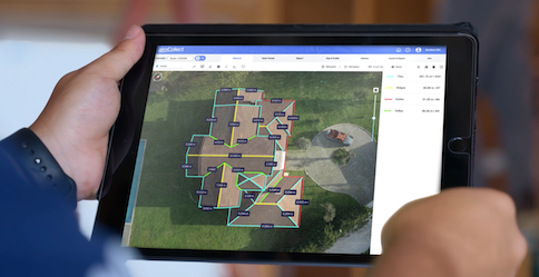
Easy-to-use software

Benefits
From capturing measurements to delivering reports, AiroCollect makes every step fast and simple.
Spend less time on measuring and routine checks.
Get results faster with fewer delays and reworks.
Stay on the ground. No climbing dangerous roofs.
Handle multi-level, irregular, and steep roofs effortlessly.
For Industries
Measurement Tools
Measure surfaces, distances, slopes, heights, and more directly from your drone scan.
Facade Tools
Capture vertical surfaces, wall areas, and elevations to support facade planning and material estimation.
Visual Proof
Deliver 2D and 3D models that include every measurement for clients, insurers, and teams.
Smart Notes
Add labels, markups, and comments directly on the site scan to guide installations, repairs, or team communication.
Site preparation in minutes
Define crane setup, lifting height and reach, scaffolding requirements, and the best material placement.
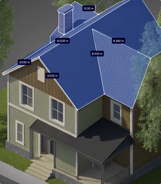
Tile Surface
76.024 m²
Ridge Length
30.032 m
Ridge Height
Ridge Angle
6.8°
Total
76.024 m² / 2 slopes
Roof Models
Scan roof shape and layout from drone imagery for solar panel planning.
Panel Simulation
Get automated calculations for azimuth, tilt angle, and estimated energy output.
Data Calculation
Provide realistic energy and performance estimates based on site conditions.
Visual Proof
Show clients what the house will look like with solar panels.
Exports
Format data into proposals and reports for fast project approval.
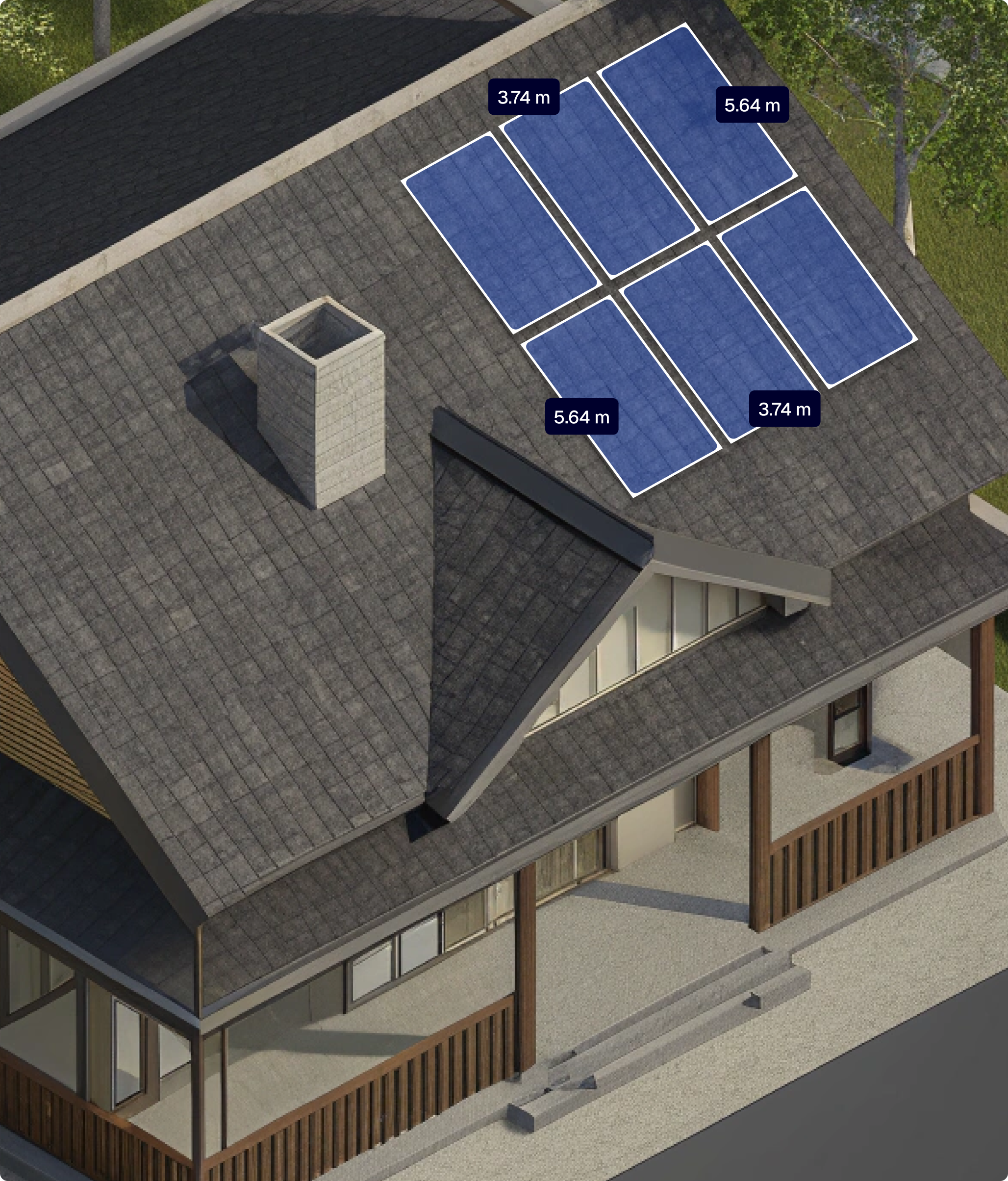
Panel Width
3.74 m
Panel Height
5.64 m
Panel Power
425 Wp
Panel Pith
37.28 °
Total
15.73 kWp / #37
Roofing Companies
Measurement Tools
Measure surfaces, distances, slopes, heights, and more directly from your drone scan.
Facade Tools
Capture vertical surfaces, wall areas, and elevations to support facade planning and material estimation.
Visual Proof
Deliver 2D and 3D models that include every measurement for clients, insurers, and teams.
Smart Notes
Add labels, markups, and comments directly on the site scan to guide installations, repairs, or team communication.
Site preparation in minutes
Define crane setup, lifting height and reach, scaffolding requirements, and the best material placement.

Tile Surface
76.024 m²
Ridge Length
30.032 m
Ridge Height
Ridge Angle
6.8°
Total
76.024 m² / 2 slopes
Solar Installation Company
Roof Models
Scan roof shape and layout from drone imagery for solar panel planning.
Panel Simulation
Get automated calculations for azimuth, tilt angle, and estimated energy output.
Data Calculation
Provide realistic energy and performance estimates based on site conditions.
Visual Proof
Show clients what the house will look like with solar panels.
Exports
Format data into proposals and reports for fast project approval.

Panel Width
3.74 m
Panel Height
5.64 m
Panel Power
425 Wp
Panel Pith
37.28 °
Total
15.73 kWp / #37
How It Works
Step 1
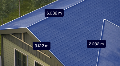
Fly or download
Use the app to autopilot your drone, fly manually or instantly download the model using LiDAR data
Step 2
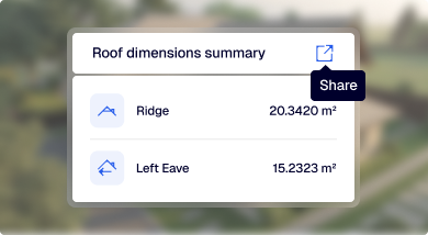
Measure
Measure all the required details of your roof and site
Step 3
Share
Share your design, report, and quotations with your team and clients
Impact
Estimate your yearly savings based on your quote volume.
At 50 quotations/year
Features
Get airtight measurements supported by visual proof to ensure flawless calculations for your clients.
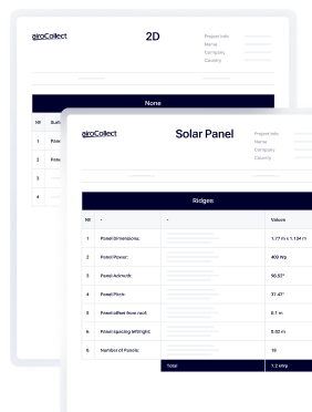
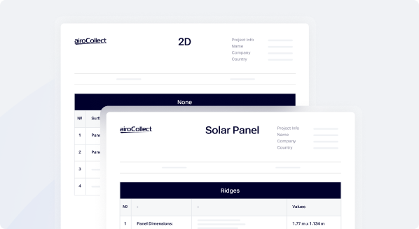
Export your data in PDF, DXF, JPG, CAD, and other industry-standard formats.
Compatible with any drone equipped with GPS or GPS-RTK. Choose the hardware that fits your workflow.
Get hands-on with AiroCollect — no credit card, no commitment. Start scanning, measuring, and quoting faster today.
Try AiroCollect free for 30 days with access to all features and tools. Includes dedicated support to help you get started fast.
Process up to four scans using any GPS camera drone. Generate 2D, 3D, and mesh outputs with just a few clicks.
No downloads or setup required. Access the platform directly from any browser on any device.
Calculate distance, surface, height, and much more. Run solar simulations and export full project reports.
Capture Tips
Flight Patterns
Linear Pattern
Flight Path
Fly in straight, parallel lines above the terrain — think of it like mowing a lawn.
Camera Angle
Set your drone’s camera to -90° (facing straight down).
Photo Mode
Enable timed shooting to capture a photo every 2 seconds automatically.
Number of Passes
Complete at least 3 orbits directly above the roof for full coverage.
Speed
Keep your drone speed low, no more than 2 meters per second.
Altitude
Maintain a consistent height of around 30 meters above the ground.
Flight Patterns
Linear Pattern
Altitude
After the main scan, fly a circular route around the structure at the same altitude.
Photo mode
Enable timed shooting to capture a photo every 2 seconds automatically.
Camera
Set the camera angle between 45° and 60° and keep the building centered in every frame.
Passes
Fly one full circle around the building.
Speed
Keep your drone speed low, no more than 2 meters per second.
testimonials
Help center
Need support flying your drone, optimizing scan results, or solving a technical issue? Our expert support team is always available to assist. Get help the way you prefer.
Enjoy full access with zero commitment. Get results in minutes.