New release – AiroCollect version 6 !
Since Monday 9/10, version 6 of airoCollect is online ! All users now have access to a lot of new features. Below you can find an overview of the most important new features.
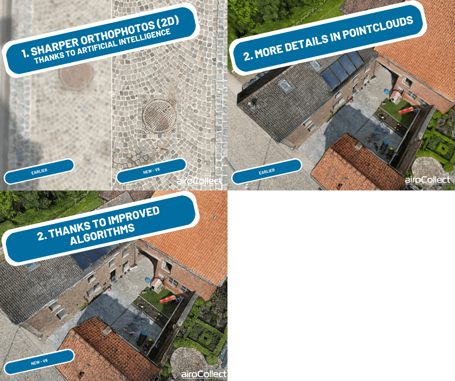
Sharper orthophotos and 3D models thanks to Artificial Intelligence
The photogrammetry software has been improved specifically for roofs and gardens. The orthophotos and point clouds are now much sharper, based on the same drone photos. We use artificial intelligence and enhanced algorithms to get a better result. New scans will be automatically processed with the improved software.
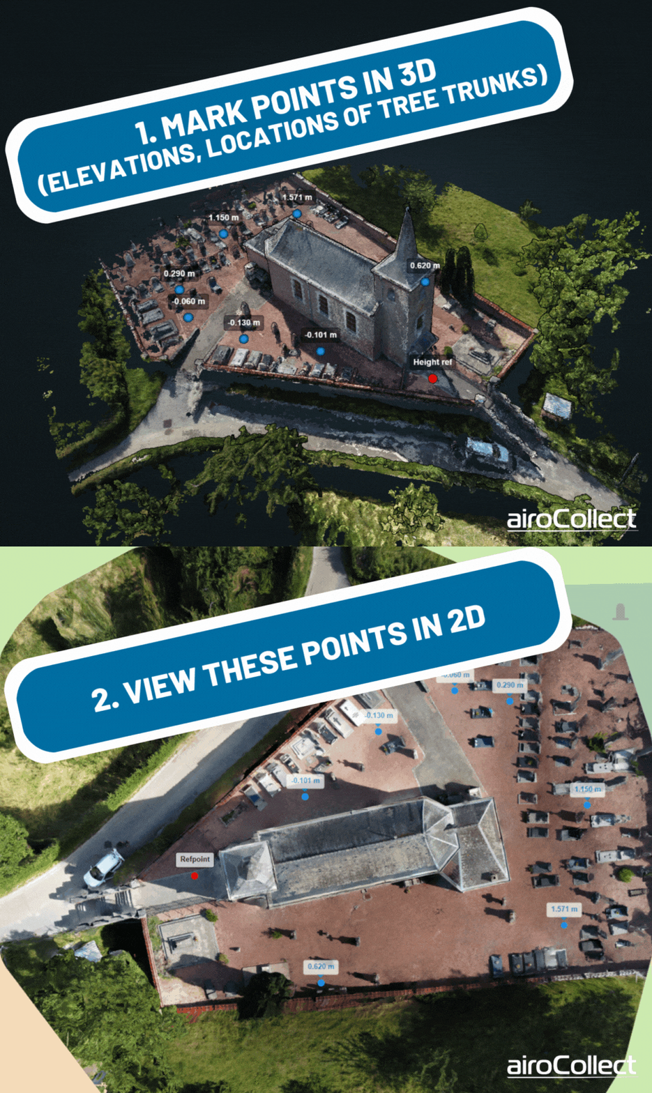
Points marked in 3D are now also visible in 2D
This is useful for displaying the elevation of the terrain in 2D and including it in your base plan of a garden. You can also use this to determine the location of points (e.g. tree trunks) that are visible in 3D but not in 2D.
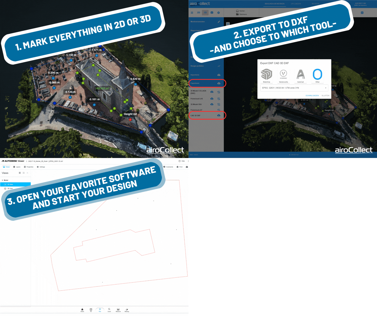
Export in dxf format – easily create a base plan
You can now export your drawing created in airoCollect as dxf format. For example, you can easily create a base plan of a garden for use in SketchUp. This works for both 2D and 3D . For example, you can indicate in 3D the outline of a building, the locations of trees, etc. You can then export this as a dxf -file to start designing your garden in your favorite software.
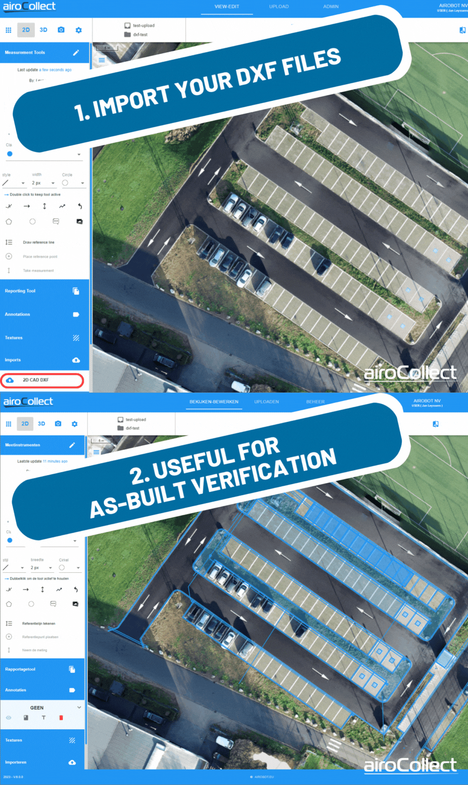
Importing dxf – make as-built verification easy
It is now also possible to load a dxf file, for example of your design. This allows you to easily monitor the evolution of a project, e.g. to support interim invoicing. This works best if you fly an RTK drone and/or use ground control points.
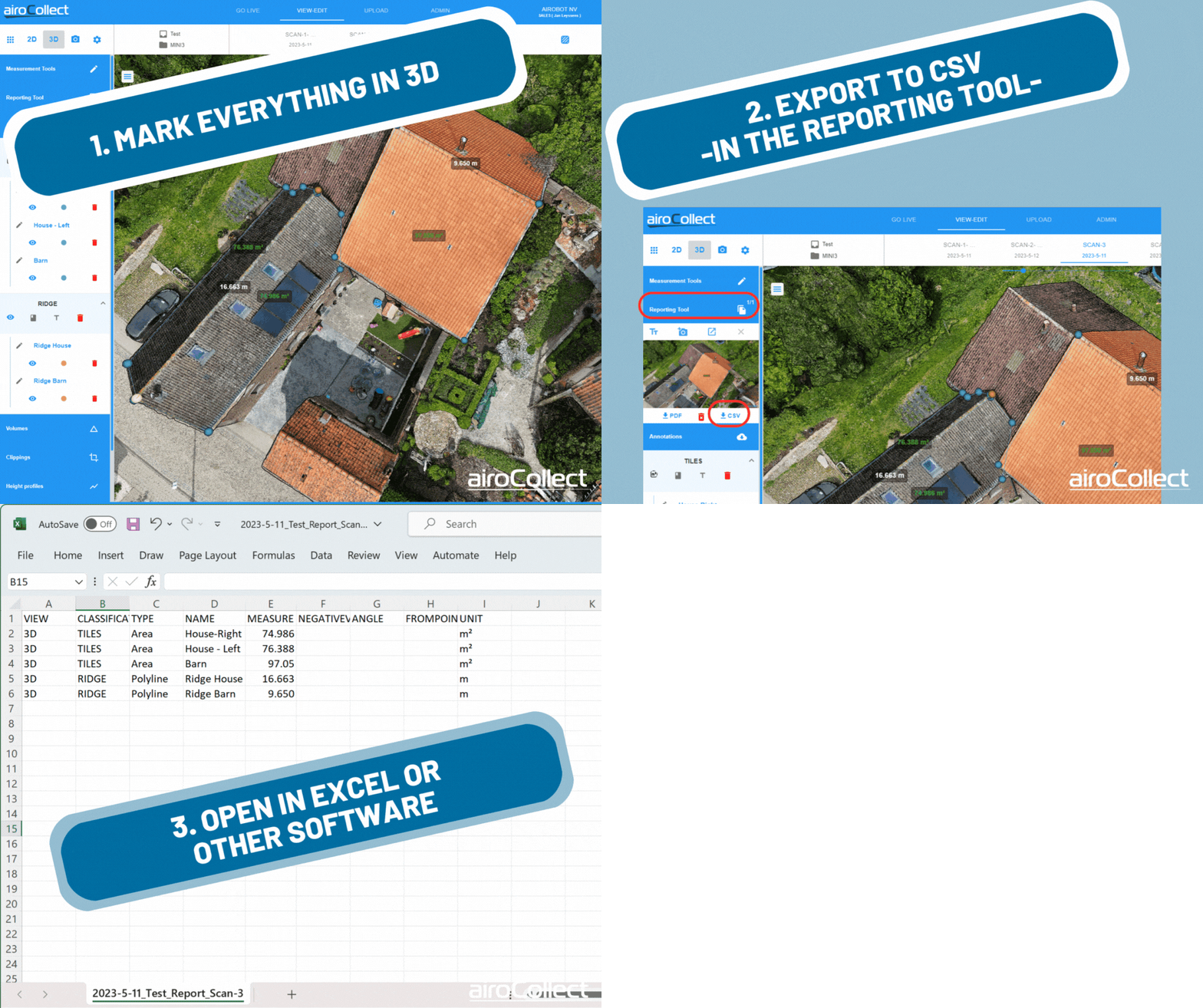
Export to CSV / Excel
It is now possible to export the measurements as .csv (comma separated values) files so that they can be easily imported into excel or other tools.
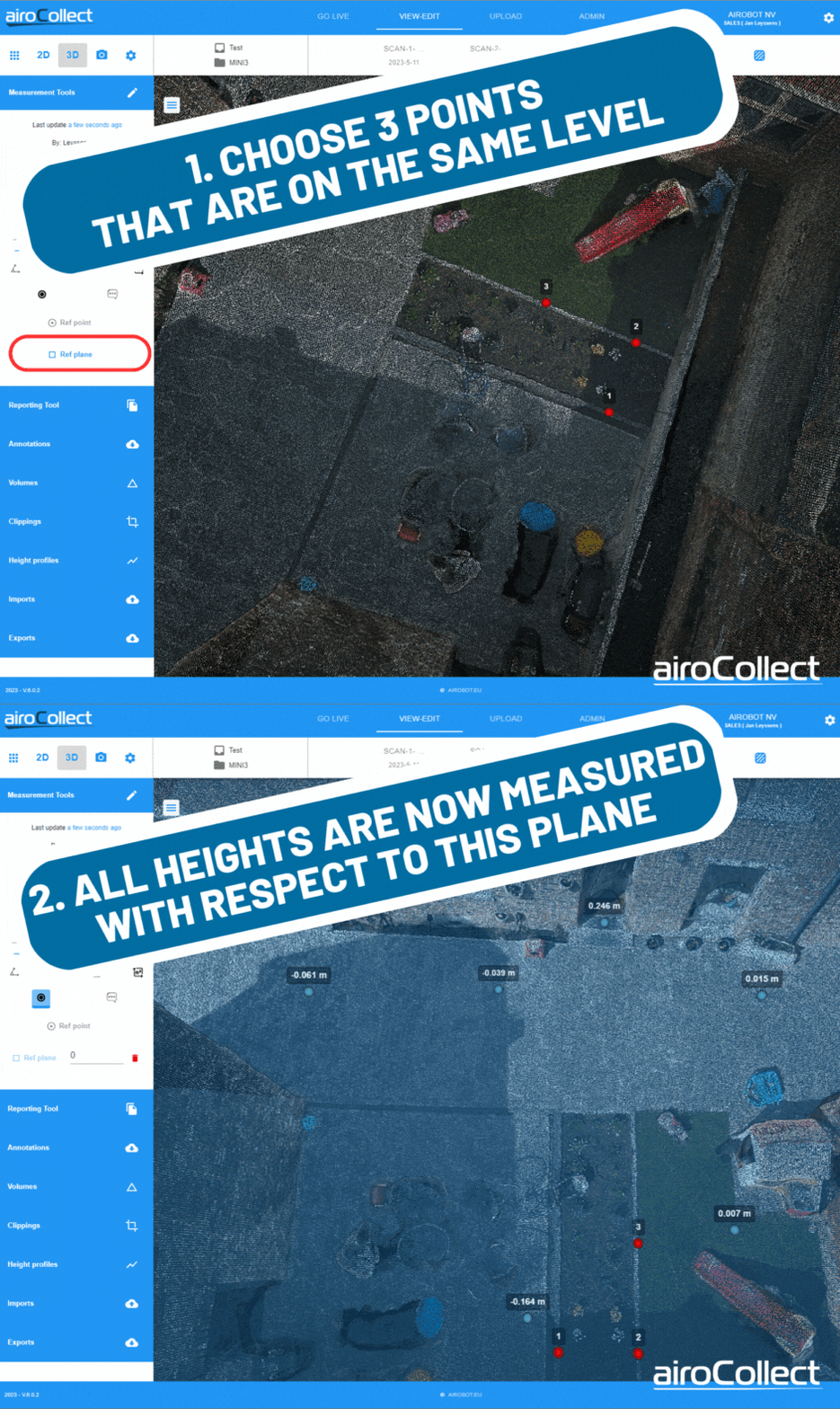
3D Height measurement relative to reference plane
If you want to measure heights very accurately, you can now also indicate a reference plane. You choose 3 points that you know lie on a plane that is level, and then you can measure the difference in height to this level anywhere on the terrain.
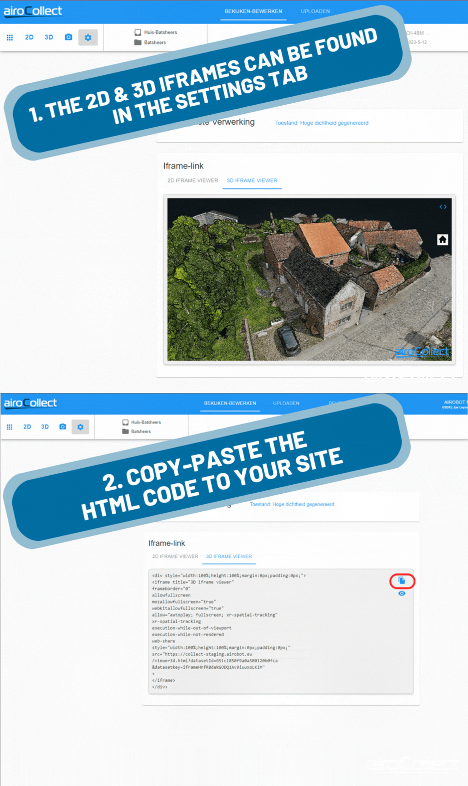
Embed your orthophoto or 3D point cloud on your website
Would you like to share your scans with your customers ? Then now you can easily integrate your orthophotos and 3D point clouds into your website via an iframe. Visitors to your website can then view the result from all sides.
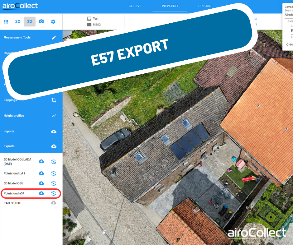
Easier export and support of e57 point clouds
You can now find the exports of each dataset in the menu on the left. The e57 point cloud format is now also supported, for example for use in ArchiCad.
Extended User Management
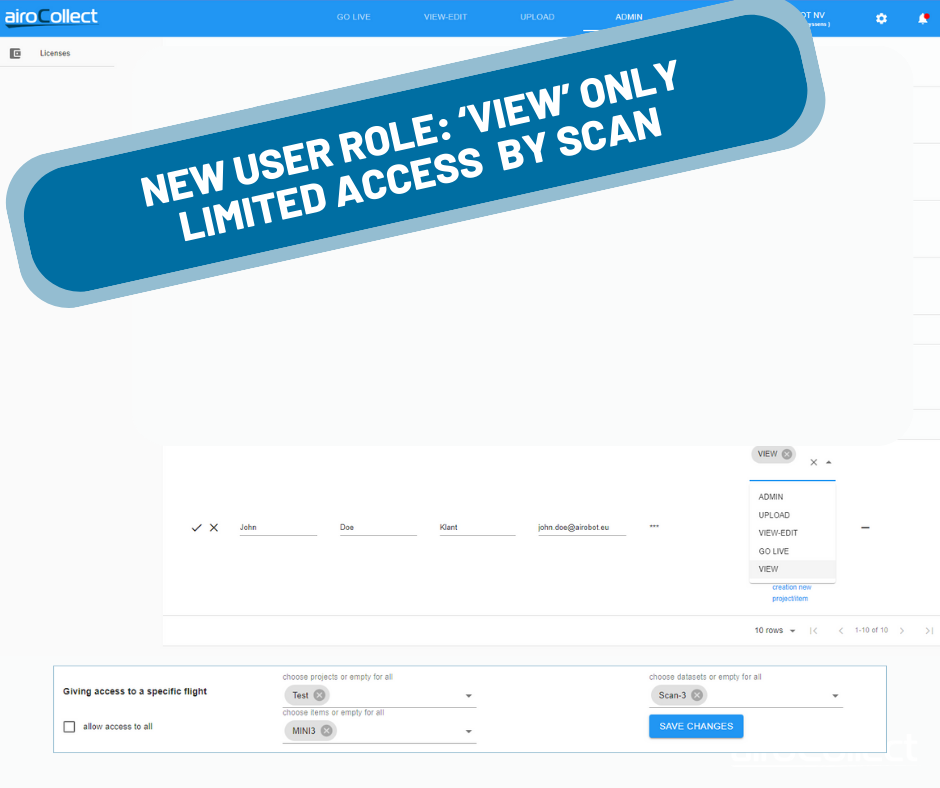
It is now possible to give users access only to one particular data set. Previously, this was only possible at the project level. It is also possible to give users only “view” rights that allow them to look at a model but not modify existing measurements. This allows you to share your measurements without your clients accidentally making changes.
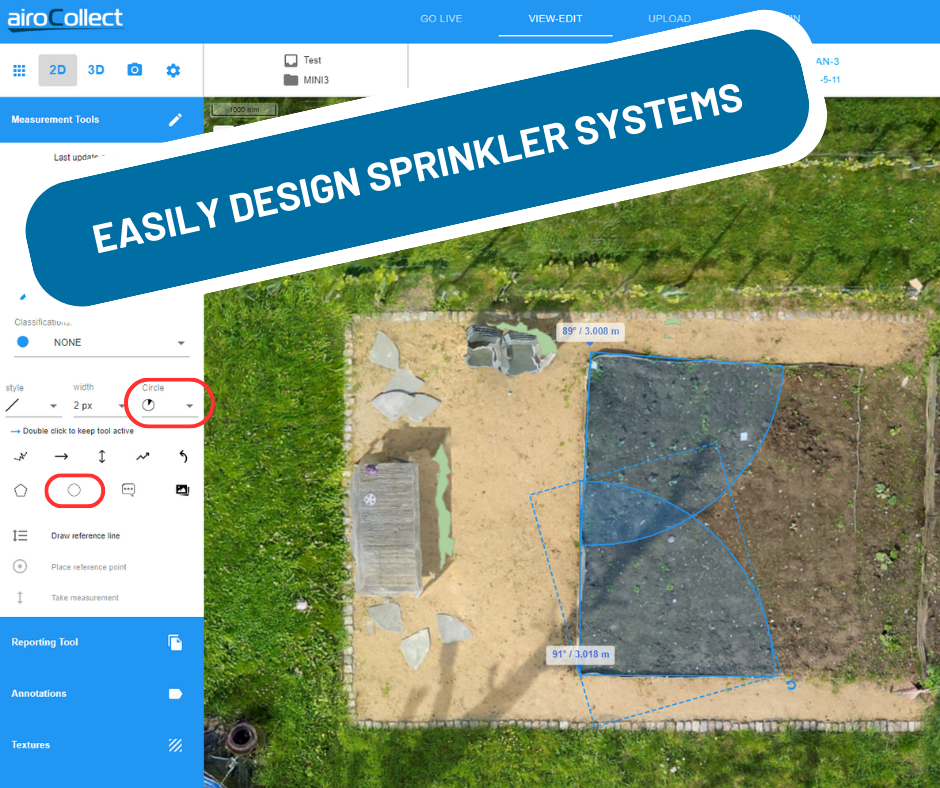
Drawing circle segments in 2D
For example, for easy plotting of sprinkler systems.
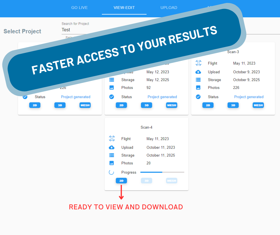
Faster access to your results
AiroCollect now shows you when 2D, 3D and MESH are ready. If you only need the 2D orthophoto, you can consult it faster and then you don’t have to wait for everything to be ready.
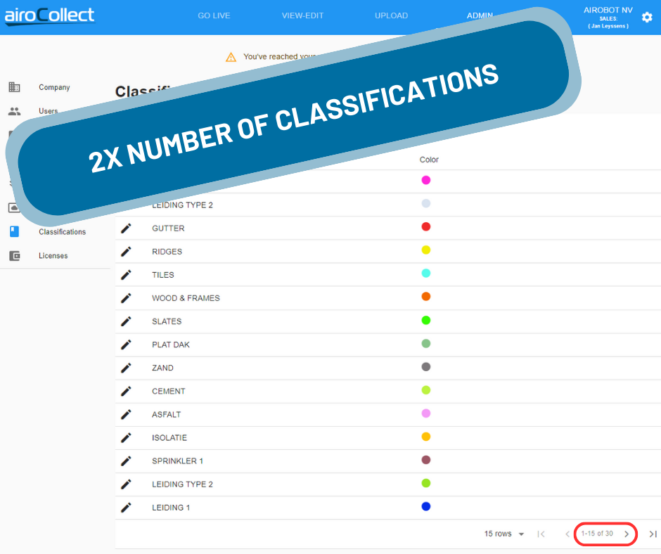
Double number of classifications
The number of possible classifications has also been increased from 15 to 30. This allows you to use additional material types or designations for your reports.
